
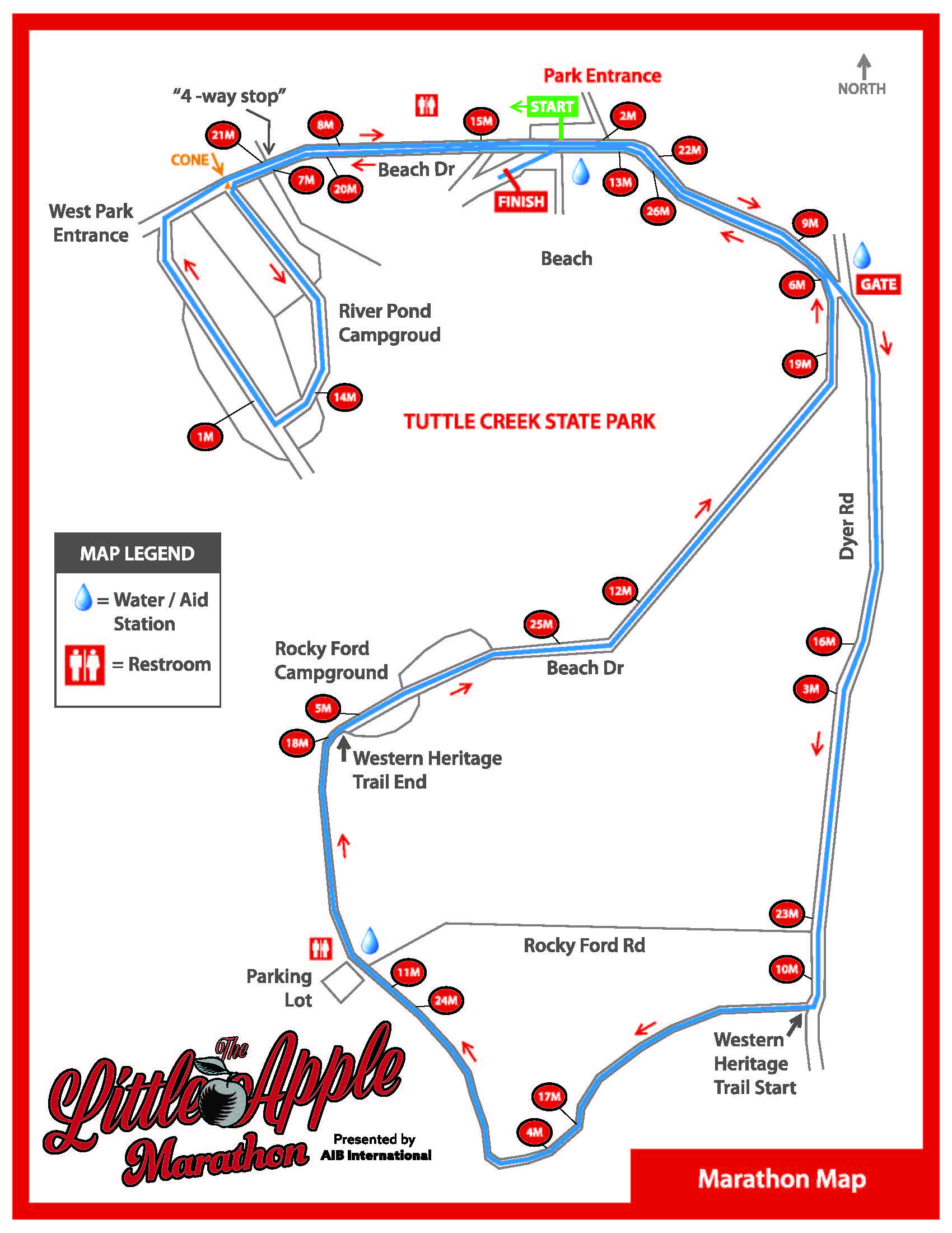
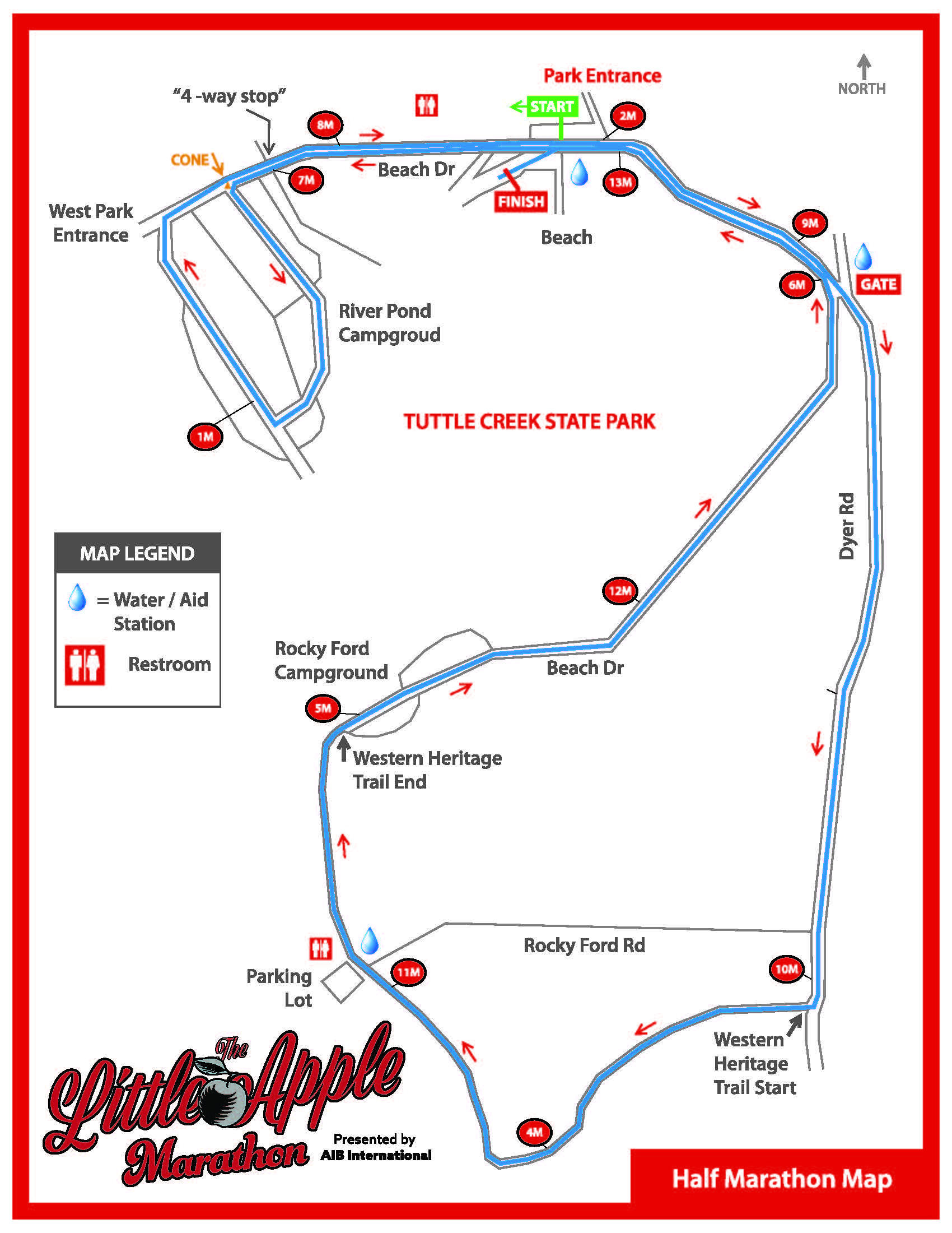
The Course
The Little Apple Marathon will take place in the Tuttle Creek State Park and surrounding area. This is a beautiful, fast course. There is only 100 feet of elevation gain in each 6.55 mile loop! The course will be mostly contained in Tuttle Creek State Park. About a 1 mile portion per loop will be on Dyer Rd., which we will have on entire side of the road closed. About 1.5 miles of the loop will be on the Western Heritage Trail (pictured below), which is basically like a sidewalk. So, by 3 miles in, you will want to be in a position you think you like as passing will be a little harder. You can go around in the grass, but the sidewalk is only about 4 feet wide, so you won't be able to run more than 2 wide at that point. This should only be an issue on the first loop as the field will spread out as the race goes on.
This course will be USATF certified and a BOSTON QUALIFIER!
Marathon, Half Marathon, and Marathon Relay Map
Marathon - 4 clockwise loops and then finish next to the start.
Half Marathon - 2 clockwise loops and then finish next to the start.
Marathon Relay - 4 clockwise loops and then finish next to the start.
MARATHON MAP
HALF MARATHON
Elevation Map - This represents one loop, so depending on the race, it may be double or quadruple this map.


